ABOUT US

The beginning of everything Good project

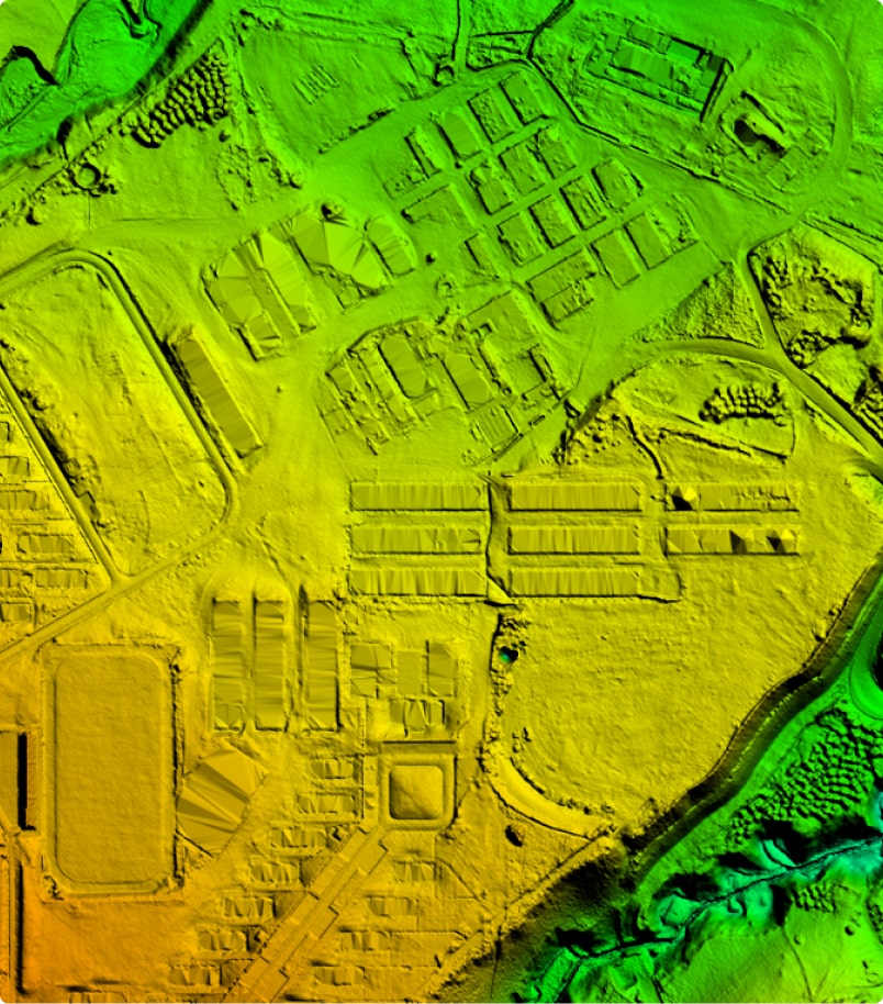
We are a team of professionals with more than 24 years of experience in the field of Digital and Geomatics Cartography, as well as the Topographic supervision, monitoring and control of various mining, engineering and construction projects.

We constantly train our specialists in the best Digital and Geomatics Cartography Institutes, of national and international recognition.

+ 150

Satisfied
Customers

+ 950

Executed
Projects

+ 4MM

Ha
raised

+ 150

Satisfied
Customers

+ 950

Executed
Projects

+ 4MM

Ha
raised

Our experience

Global Mapping seeks the full satisfaction of its current and future clients, for this it has oriented its actions to the use of cutting-edge technologies.

Our mission 

To provide a specialized and personalized service in Digital Cartography solutions through the use of state-of-the-art technology that allows us to reach the levels of precision to satisfy the needs of our clients.

Our vision 

To be a leader in Digital Cartography solutions and an international reference in the field of Geomatics.

Our values

What makes us different

  • Technology

    Innovation in each of the processes of our services for the optimal development of projects.
  • Quality and precision

    Develop each project with the highest quality standards in accordance with local and international technical standards.
  • Trust

    Commitment and confidentiality in the execution of projects for the full satisfaction of our clients.

Quality, Safety, Occupational Health and Environment Policy

ISO 9001: 2015 Certification

We are a company dedicated to provide digital cartography solutions, aimed at meeting the requirements of our customers, reaching levels of accuracy that ensure your confidence
With a view to being sustainable over time, we prioritize the safety and health of our collaborators and carry out our operations in a non-invasive and responsible manner towards the environment.

Scope of ISO 9001: 2015 Certification

"Geomatics, Topography, Photogrammetry, LiDAR, Assignment of Topographic Grid for Project Supervision Services"

We are a Member of:

OUR TEAM

Group of Experts

In order to promote the human talent of Global Mapping, our professionals and technicians are trained in the country and abroad.
    • Geographical Engineers
    • Civil Engineers
    • Cartographer Engineers
    • System Engineers
    • Geodesta
    • Senior Topographers
    • Topographers’ assistants
    • Topógrafos Seniors
    • Pilots
    • Aeronautical Technicians
    • Photogrametrists
    • LiDAR specialists
    • Digital Aerial Cameras Operators
    • Cartographic Editors
    • Logistics
    • Accountants
    • Administrators
    • Communicators

HISTORY

Our timeline

  • 2000

    100% digital photogrammetry with analog cameras

    Conventional topographic surveys, orthophotos. Digital photogrammetry with color photo scanning.
  • 2005

    Start of Topographic supervision of Mining Megaprojects

    Assignment of topographic crews at the Corianta mine.
  • 2009

    Start of topographic surveys with GNSS system - RTK

    Milpo UM Cerro Lindo Mining Company
  • 2010

    100% digital photogrammetry with digital cameras

    Acquisition of the First Rollei Digital Aerphotographic Sensor
  • 2011

    100% digital photogrammetry with digital cameras

    Acquisition of the First Rollei Digital Aerphotographic Sensor
  • 2012

    ISO 9001:2008

    On April 23, 2012, we achieved the Iso 9001: 2008 certification, marking a very important milestone in the Quality System and requirement in each link of Global Mapping.
  • 2012

    Country Brand Peru

    At the beginning of 2012, through PROMPERÚ, we had the honor of being Licensees of the Peru Country Brand in Institutional use at the national and international level. We currently have our license for institutional use until 2023.
  • 2013

    Start as a Commercial Aviation Operator: Aerial Work - Prospecting and Photography

    The General Directorate of Civil Aeronautics (DGAC) on July 26, 2013 granted Global Mapping the Air Services Operator Certificate, which authorizes it to carry out commercial aviation operations: aerial work - photography, under RAP 91 in accordance with said rule.
  • 2014

    First Airborne LiDAR Sensor

    Acquisition of the First Airborne LiDAR Sensor ALS 70HA with IR, color and Phase One
  • 2015

    High impact conventional topography

    Implementation of Terrestrial LiDAR Scanner in the execution of projects
  • 2017

    Acquisition of the Second Aerphotographic Sensor with Infrared Sensor

    • RGB and IR sensors (Color and Infrared) • High Image Resolution, 100 Megapixels (11608 x 8708 pixels) • 4.6 Micron pixel size • Shutter speed 1/2500 Seconds • It has FMC (Progressive Movement Compensation)
  • 2018

    ISO 9001:2015

    On February 28, 2018, we got the renewal of our Iso 9001 version 2015.
  • 2019

    Implementation of Mobile LiDAR Sensors (MLS)

    Mobile LiDAR system used in: Surveys of tunnels, low voltage lines, structures made with operator movement.
  • 2019

    IPGH

    Since June 04, 2019, we have been a Cooperating Partner of the Pan American Institute of Geography and History (PAIGH), a Specialized Organization of the Organization of American States (OEA)
  • 2019

    Acquisition of the second latest generation TerrainMapper LiDAR Sensor and RGB and Infrared sensors

    AIRBORNE LIDAR SYSTEM • High density of terrain points from 1 to 100 per m2. • First modern team in South America. • Absolute precision of 5cm vertically and 5cm horizontally. • Minimum field control and for scales less than 2000 ha without field control. • High spatial resolution color and infrared photographs from 3cm and 4 integrated bands. • Stabilized rotation system for better alignment of photos and data. • Ideal for agriculture, road works, transmission lines and glaciers. • Pulse repetition frequency greater than 2,000 kHz. • It adapts to all types of terrain.
  • 2020

    ISPRS

    We are a Sustaining Member of The International Society for Photogrammetry and Remote Sensing, it is an international non-governmental organization that enhances international cooperation between world organizations with interests in photogrammetry, remote sensing and spatial information sciences.
  • 2021

    ISO 9001:2015

    Renewal of our Iso 9001: 2015 certification from April 23, 2021 to April 22, 2024
  • 2021

    Implementation of AI in the elaboration of the Cartographic and LiDAR edition

    Improved point cloud classification process and image object recognition.
  • 2022

    Implementation of the Trinorm

    With a view to being sustainable over time, we prioritize the safety and health of our employees and carry out our operations in a non-invasive and environmentally responsible manner.
  • 2024

    Cutting Edge Technology

    LiDAR TerrainMapper 2, ECOSONDA and Wingtra One update