Territory and Environment Sector
Mapping and cadastre for environmental studies and land-use planning
We produce the terrain models, orthophotos and thematic maps each study needs, and measure what changed from one campaign to the next. Since 1999 we have surveyed more than 5 million hectares.
An environmental study, a cadastre or a land-use plan is discussed over a map, and that map is reviewed by the authority, the project owner and often the local community. So what we deliver is tied to the official geodetic network, inside a geospatial database another specialist can open and check.
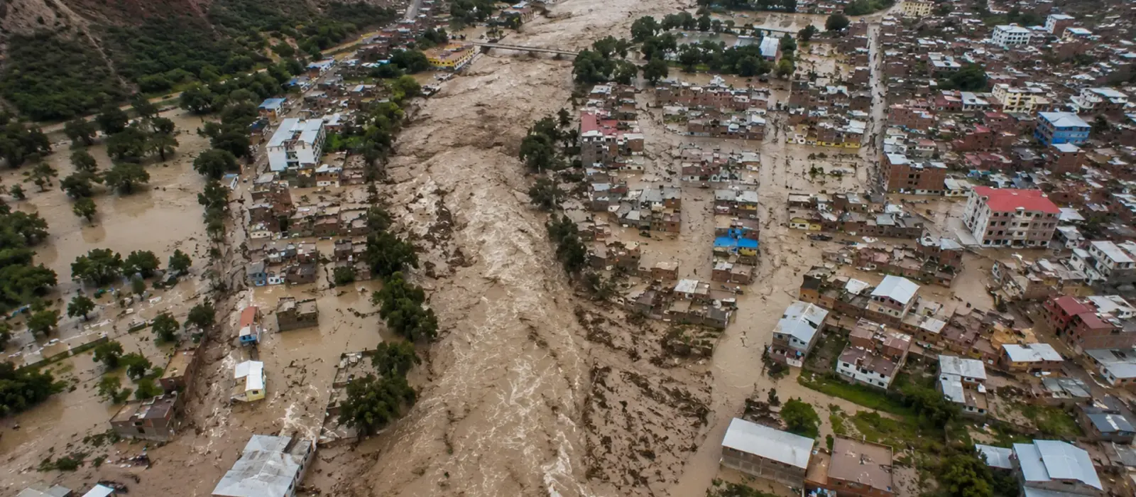
Then comes the follow-up: deforestation, land-use change, erosion, debris flows and landslides. Satellite imagery covers large areas and shows land-cover change well, but it cannot see the ground under the forest. To measure the ground beneath the canopy, we fly LiDAR.
Experience and results
- 5M+
- hectares surveyed
- 1200+
- projects delivered
- 200+
- clients
Where we work in territory and environment
Land-use planning
Base mapping, terrain models and spatial analysis for the plan and its follow-up.
Urban and rural cadastre
Parcel surveys, land title regularization and a geospatial database.
Land cover and land use
Multispectral remote sensing and land-cover classification with change detection.
Protected natural areas
Boundary delineation, buffer zones and deforestation monitoring.
Environmental liabilities and closure
Inventory, volume calculations and multitemporal tracking of closure plans.
Watersheds and risk zones
Hazard, vulnerability and risk mapping for preventive management.
Four business lines, from planning to monitoring
Plan, design, build, operate and monitor. The same four lines in every sector, with the activities and deliverables that sector needs.
Levantamiento, Cartografía y Modelado
Survey, Mapping & Modeling
“From a single parcel to a whole watershed, we survey the ground and its vegetation”
- Airborne, terrestrial, mobile and drone LiDAR of the ground and its vegetation cover
- Surveying, geodesy, GNSS networks and precise leveling
- Digital photogrammetry, orthophotos and DTM and DSM models
- Remote sensing and multispectral satellite imagery for land-cover and land-use analysis
- Digital mapping, thematic maps and terrain modeling
- Hydrographic and bathymetric surveys of water bodies and riverbank buffer strips
- 3D modeling and digital twins of the ground and its infrastructure
- Urban and rural cadastre, land management and land regularization
- Delineation of protected natural areas, concessions and buffer zones
Deliverables
Classified point cloud · DTM/DSM · High-resolution orthophoto · Thematic land-cover and land-use maps · Cadastral plans and maps · 3D models · Geospatial database (GDB)
Control y Aseguramiento de Calidad
Quality Control & Assurance
“We cross-check cadastre, maps and official sources until they agree”
- Geodetic control and official georeferencing of land and environmental studies
- Geometric verification and positional quality control of surveys and maps
- Independent audits of topographic, LiDAR, photogrammetric and satellite surveys
- Geospatial QA/QC to international standards and project specifications
- Validation of geospatial databases and their topological consistency
- Reconciliation of cadastral, land and environmental data across official sources
- Validation of geospatial data for technical dossiers and environmental studies
Deliverables
Geodetic control report · Geometric verification record · QA/QC report (ISO 19157 / ASPRS) · Topological consistency report · Reconciliation drawings · Independent audit report
Monitoreo del Territorio y Gestión de Riesgos Ambientales
Land Change & Environmental Monitoring
“We measure how much forest was lost and how much soil eroded between campaigns”
- Multitemporal monitoring with LiDAR, drones, GNSS and satellite imagery for change detection
- Tracking of deforestation, erosion and land-cover and land-use change
- Monitoring of slope stability, landslides and geological risk zones
- Assessment and follow-up of environmental liabilities and closure plans
- Hazard, vulnerability and risk mapping for land management
- Monitoring of water bodies, riverbank buffer strips and flood-prone areas
- Instrumentation, GIS and spatial analysis combined for preventive risk management
Deliverables
Multitemporal change reports · Deforestation and land-cover maps · Hazard, vulnerability and risk maps · Environmental monitoring reports · Threshold-based technical alerts · Risk management reports
Soluciones Digitales e Inteligencia Artificial
Digital Solutions & Artificial Intelligence
“We classify land cover with AI and publish the maps on your GIS platform”
- Digital twins of the territory, updated with each monitoring campaign
- GIS platforms and spatial data infrastructures (SDI) to manage and publish land information
- Automatic land-cover classification and change detection with artificial intelligence
- Geospatial dashboards to track land and environmental indicators
- 3D virtual tours for inspection, planning and remote participation
- Predictive analysis and AI to anticipate environmental risks and pressure on the land
Deliverables
Digital twin of the territory · Integrated GIS / SDI platform · Geospatial dashboard · Predictive models and automated reports · 3D virtual tours
Who we work for
- Environmental authorities
- Regional governments
- Local governments
- Environmental consultancies
- Project owners
- Social and land-management teams
- Banks and investors
- GIS and remote-sensing specialists
Brochure
Download the sector brochure
Leave us your details and download the sector brochure, with our lines of work, activities and deliverables.