Water Resources Sector
How much the reservoir holds today, and how the dam is behaving
We measure the reservoir bed with bathymetry from uncrewed surface vessels (USV), and the dam with GNSS, surveying and geotechnical instruments. You receive an updated area-volume curve and a deformation series for the structure.
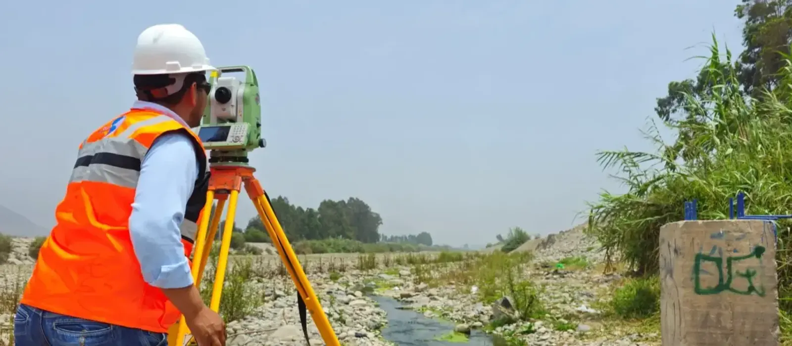
Every flood season leaves sediment in the reservoir, and the area-volume curve from the original design stops matching what the reservoir actually holds. Our airborne LiDAR stops at the water surface, so we merge the bathymetry of the bed with LiDAR of the banks into a single topo-bathymetric model.
Outside the reservoir, we model rivers and streams for flood studies, check canal gradients, scan intakes and treatment plants for the As-Built, and delineate riverbank and lakeshore buffer strips.
Experience and results
- 5M+
- hectares surveyed
- 1200+
- projects delivered
- 200+
- clients
Where we work in water resources
Dams and reservoirs
Bathymetry, area-volume curves and deformation monitoring of the structure.
Hydroelectric plants
Surveys and 3D models of intakes, conveyance works and powerhouses.
Canals and irrigation systems
Mobile mapping of the network, gradient checks and infrastructure inventory.
Rivers and river basins
Channel and floodplain modeling, and tracking of how the river channel shifts.
Treatment plants and networks
3D laser scanning, As-Built BIM models and pipe network mapping.
Riverbank protection and drainage
Topo-bathymetric surveys, and tracking of erosion and sedimentation.
Four business lines, from planning to monitoring
Plan, design, build, operate and monitor. The same four lines in every sector, with the activities and deliverables that sector needs.
Levantamiento, Cartografía y Modelado
Survey, Mapping & Modeling
“We survey rivers, reservoirs, lakes and canals, above and below the water”
- Airborne, terrestrial, mobile and drone LiDAR over basins, river channels and hydraulic corridors
- Surveying, geodesy, GNSS networks and precise leveling
- Digital photogrammetry, orthophotos and digital terrain (DTM) and surface (DSM) models
- Hydrographic and bathymetric surveys of rivers, reservoirs, lakes and coastal areas
- Mobile mapping of canals, conveyance tunnels and water networks
- Digital mapping and modeling of river channels and floodplains
- 3D modeling, digital twins and As-Built BIM models of dams, intakes and plants
- Geospatial inventory of hydraulic infrastructure
- Cadastre of water sources, riverbank buffer strips and land title regularization
Deliverables
Classified point cloud · DTM/DSM · Bathymetry and area-volume curves · High-resolution orthophoto · Topographic plans and maps · 3D models · As-Built BIM · Digital inventory of hydraulic infrastructure
Control y Aseguramiento de Calidad
Quality Control & Assurance
“We audit canal elevations, reservoir volumes and third-party surveys”
- Geodetic control and setting out at dams, intakes, canals, tunnels and treatment plants
- Geometric verification and dimensional control with surveying, LiDAR and 3D laser scanning
- Independent audit of topographic, bathymetric, LiDAR and photogrammetric surveys
- Geospatial QA/QC to international standards and project specifications
- Validation and integration of BIM models, GIS data and point clouds for engineering and construction
- As-Built control and asset verification during construction, operation and maintenance
- Validation of reservoir, dredging and earthwork volumes
Deliverables
Geodetic control report · Geometric verification record · As-Built report · QA/QC report (ISO 19157 / ASPRS) · Setting-out drawings · Independent audit report
Monitoreo de Infraestructura Hídrica y Gestión de Riesgos
Ground & Hydraulic Infrastructure Monitoring
“Each bathymetric survey against the last one, each dam reading against its threshold”
- Geotechnical instrumentation of dams, dikes, reservoir slopes and canals
- Geodetic and topographic monitoring of deformation, settlement and displacement
- Multitemporal monitoring with LiDAR, drones, GNSS and InSAR for early change detection
- Tracking of erosion, sedimentation and river channel changes
- Monitoring of reservoirs, glaciers and glacial lakes
- Integration of instrumentation, GIS and spatial analysis for risk prevention
- Assessment of how critical infrastructure performs during operation
Deliverables
Periodic deformation reports · Multitemporal change maps · Comparative bathymetry and sedimentation rates · Geotechnical performance reports · Threshold-based technical alerts · Risk management reports
Soluciones Digitales e Inteligencia Artificial
Digital Solutions & Artificial Intelligence
“Reservoir volume and sedimentation, updated with every bathymetric survey”
- Digital twins of dams, hydropower plants and conveyance systems, updated with each monitoring campaign
- BIM + GIS integration to manage water assets and projects in one place
- Hydraulic and hydrological modeling supported by geospatial analysis and artificial intelligence
- Geospatial dashboards to track water indicators
- 3D virtual tours for inspection, planning and remote collaboration
- Predictive analytics and AI to anticipate flood, water shortage and asset failure risk
Deliverables
Digital twin of the water infrastructure · Integrated BIM + GIS platform · Geospatial dashboard · Predictive models and automated reports · 3D virtual tours
Who we work for
- Water authorities
- Regional governments
- Consulting and engineering firms
- EPC contractors
- Water system operators
- Hydraulic engineers
- Banks and investors
- GIS specialists
Brochure
Download the sector brochure
Leave us your details and download the sector brochure, with our lines of work, activities and deliverables.